
114 years.
That's how long it has been since since miners labored to discover gold ore underground at one of Dahlonega's most popular historical sites.
In a place as fascinating as an old gold mine, there is always one question that persists—what mysterious things have yet to be discovered in the unexplored tunnels.
Next year will mark the 30th anniversary of underground tours at Consolidated Gold Mine.
With visitors coming to see the Dahlonega attraction in record numbers this year, the staff at the mine is working on a way to give them an even better experience.
"We want to be able to celebrate the anniversary by expanding the tour," said Dathan Harbert, manager at Consolidated.
That's when his path crossed with a Buford-based company that creates computer models of industrial sites.
"We had just finished telling the owners here that we wanted to expand the tour," Harbert said.
"Inspired Intelligence happened to contact us soon after that and wanted to test their technology in a 'challenging' environment."
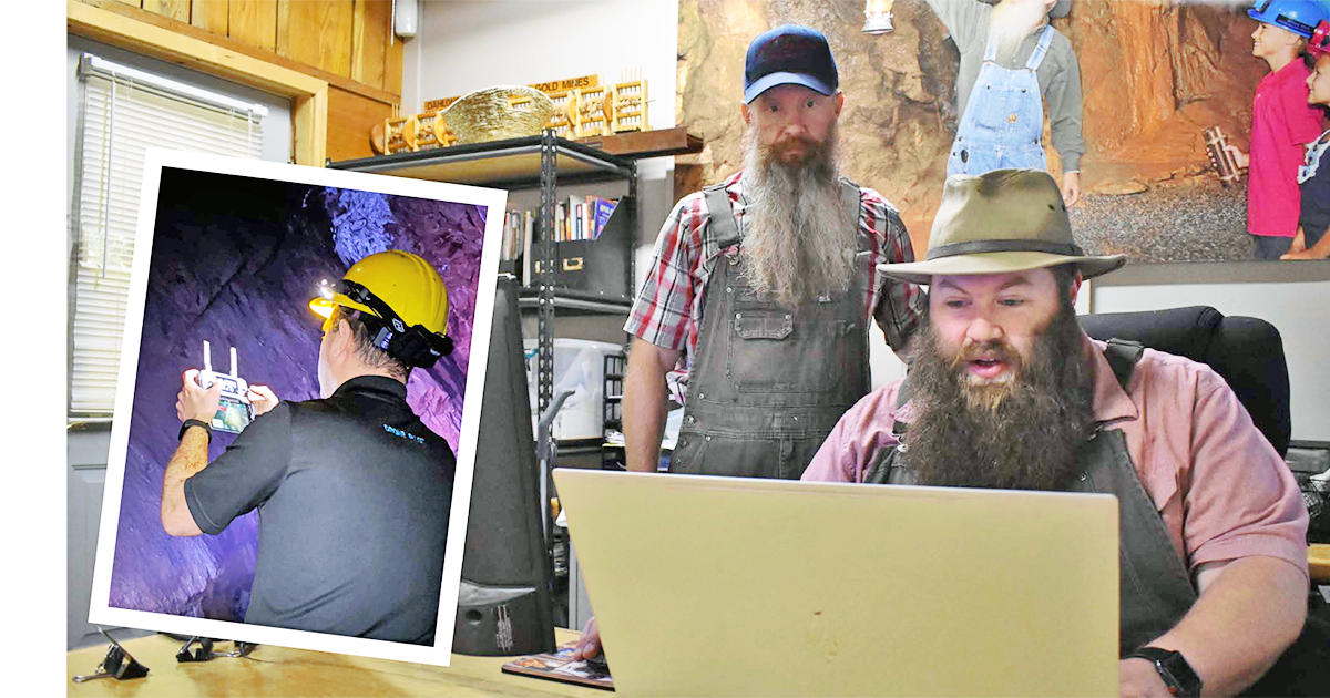
Nir Pe’er (company founder and CEO) and his wife Amanda brought their equipment to the mine to begin the project.
"We spent many days going through the tunnels," Harbert said. "They pushed the technology beyond what it was previously used for."
The goal of the project was to map out some of the tunnels that have not been explored since the mine was shut down in 1906.
"This is the first time the mine has actually been mapped," Harbert "Previously there were just written journals beginning from when the mine was opened in 1898."
Harbert said that in order to take visitors into new areas of the mine, they must know how safe the tunnels are.
"Their scans showed the height and width of the tunnels and also the density of the rock surrounding the tunnel," Harbert said.
This information will allow Consolidated to know which parts of the mine can be opened up for tourists to walk through.
"He had on a backpack with a 360 degree laser sticking up," Harbert said. "Any areas that he couldn't walk through sections of the tunnel he used a drone"
Pe’er said his company usually uses the technology to do inspections, drone surveys, and other commercial drone work.
"Recently we implemented even more exciting technology, including LiDAR, which scans with lasers to produce very accurate data that could be used to scan any site above or under ground," Pe’er added.
He said the technology can be used to produce a 3D model, make blueprints, and take measurements to a high accuracy.
But in the mine, they used their drones in even more challenging way.
Pe’er said that one of the reasons they took on this project was to "put our skills and equipment to the test underground and do something that hasn't been done before."
Often navigating through tight spaces, they flew drones through the underground tunnels and also used underwater drones to capture video of previously unknown parts of the mine.
Having visited and toured the mine many times in the past, Pe’er said he is excited to do this project to "record and preserve history for the first time and to produce data that could help the mine in future projects and help first responders in case of an emergency."
MORE TO COME
With all the progress made so far in making 3-D maps of the tunnels, they aren't finished.
Inspired Intelligence will be returning to map more of the unexplored tunnels.
"The exploration into new areas of the mine is still undergoing to discover, to ensure safety, and most importantly, to record history," said Pe’er.
With more tunnels to see, there is also more hands-on work to be done.
Harbert said there will be more exploration of the elevator shaft that is near the original entrance to the mine.
The shaft goes down 40 feet currently, but is believed to be another 160 feet deep.
After a significant amount of debris is cleaned out, more drone footage and scanning can be done.
This, along with two other levels of the mine which have yet to be mapped, will keep the team busy in the future.
Harbert pointed out how much the Inspired Intelligence [iidronesusa.com/] crew has allowed them to do that was previously impossible.
"We really enjoyed working with [them]," he said. "They were very professional and nice and have become real friends."